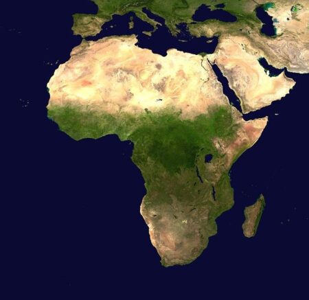
The African Union has called for the widespread adoption of a world map that more accurately represents the continent’s true size, urging global institutions and governments to rethink traditional cartographic depictions. The initiative aims to challenge outdated Eurocentric maps that have long minimized Africa’s scale, promoting a more balanced and accurate understanding of the continent’s geographical and geopolitical significance. This move, highlighted in a recent Reuters report, underscores Africa’s push for greater recognition on the world stage and calls for educational and diplomatic systems worldwide to update their representations accordingly.
African Union Calls for Global Recognition of Africa’s Geographic Scale
The African Union (AU) has issued a strong appeal to global cartographers and educational institutions to embrace world maps that accurately represent Africa’s immense landmass. The organization points out that the prevailing Mercator projection, widely used in schools and media, severely distorts the continent’s size, making it appear much smaller than it actually is. According to the AU, this misrepresentation perpetuates misconceptions about Africa’s geographical and economic significance on a global scale.
To reinforce their message, the AU provided comparative data highlighting the scale of Africa alongside other continents using alternative map projections. They stressed that adopting maps with an equitable scale could:
- Promote a more accurate understanding of Africa’s natural resources and biodiversity
- Enhance global awareness of the continent’s strategic geopolitical role
- Correct long-standing educational biases that undermine Africa’s contributions to world history and development
| Continent | Approximate Area (million km²) | Misrepresentation in Mercator |
|---|---|---|
| Africa | 30.37 | Shown smaller than actual size |
| Greenland | 2.16 | Appears larger than Africa |
| Europe | 10.18 | Accurately represented |
Impact of Misrepresented Maps on Perceptions and Development Policies
For decades, the widespread use of distorted maps, such as the Mercator projection, has significantly skewed global perceptions of Africa’s true geographical size and importance. These misrepresentations have not only diminished the continent’s perceived scale but have also influenced international attitudes toward its economic and developmental potential. The visual minimization often leads policymakers and investors to underestimate the market size, resource wealth, and infrastructural needs of African nations, perpetuating outdated stereotypes of underdevelopment and marginalization.
The consequences extend beyond mere perception:
- Trade agreements may undervalue African markets due to a lack of accurate spatial understanding.
- Development aid and infrastructure projects risk misallocation based on skewed geographic data.
- Global education systems continue to engrain these misconceptions, affecting future generations’ worldview.
| Misrepresented Aspect | Impact | ||||||
|---|---|---|---|---|---|---|---|
| Continent Size | Perceived as smaller than South America or Europe | ||||||
| Resource Distribution | Underestimated economic potential and natural wealth | ||||||
| Development Planning |
| Misrepresented Aspect | Impact |
|---|---|
| Continent Size | Perceived as smaller than South America or Europe |
| Resource Distribution | Underestimated economic potential and natural wealth |
| Development PlanningRecommendations for Educational and Media Integration of Accurate African Cartography
To foster a comprehensive understanding of Africa’s geographical prominence, educators and media professionals are called to integrate more precise cartographic representations into their materials and broadcasts. This effort includes replacing outdated maps that downplay the continent’s scale with those that accurately reflect its vastness. Visual aids should leverage projections like the Gall-Peters map, emphasizing proportional size over distortion, to reshape perceptions and challenge lingering Western-centric narratives. Moreover, school curricula must actively promote critical discussions on map biases to empower students with geographic literacy and historical context.
On the broadcasting front, media outlets should prioritize the correct representation of Africa during global reports and documentaries, ensuring audiences receive a realistic perspective. Collaborative initiatives between cartographers, educators, and media houses can produce engaging content such as infographics and video explainers that highlight Africa’s substantial contributions to the world-not merely geographically, but politically and economically as well. Embedding these accurate visuals in everyday consumption will aid in dismantling centuries-old misconceptions and promote a balanced global worldview. In SummaryAs the African Union continues to advocate for a more accurate representation of the continent’s size on world maps, the push highlights broader calls for greater recognition of Africa’s geopolitical and economic significance. Experts argue that updating global cartography could help challenge longstanding misconceptions and promote a more balanced understanding of the world’s geography. While the proposal gains traction among educators and policymakers, its adoption will depend on international cooperation and the willingness of mapmakers worldwide to embrace a revised perspective. |


